Osmeña Peak: sunrise over Cebu’s jagged hills
Cebu’s highest point is an easy walk to a sea of sharp green hills, with mist in the valleys and both coasts visible on clear mornings.

- Area
- Highlands & heritage
- Start from
- Mantalongon, Dalaguete
- Distance
- about 1 km walk from the trailhead
- Time needed
- 1 day or an overnight
- Best season
- Best December – May; cooler mornings all year
- Difficulty
- Easy
- Transport
- Bus or car to Dalaguete, then habal-habal up the mountain
- Tickets & rules
- Small trail and registration fee
Why go
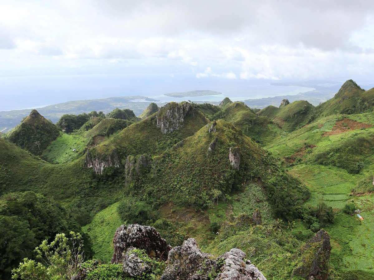
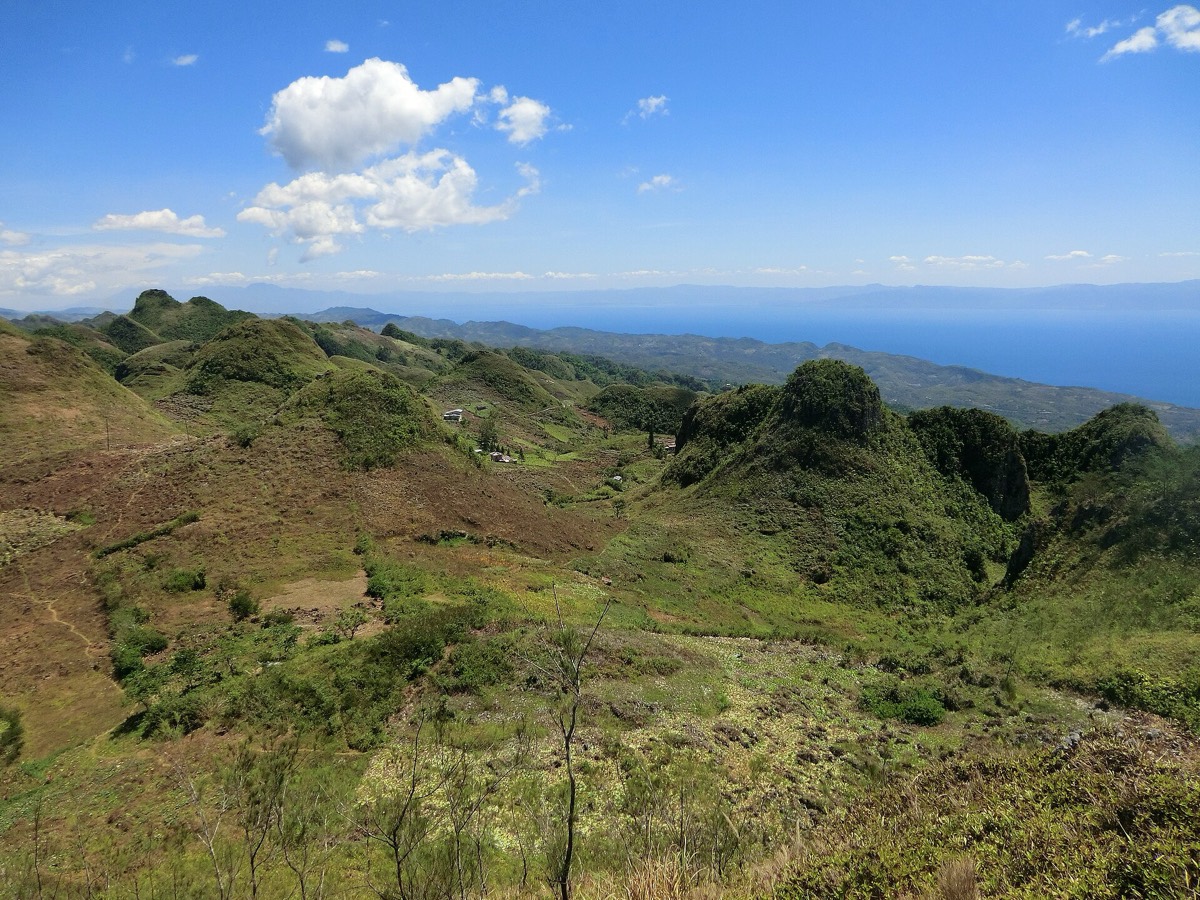
Osmeña Peak is a surprise: you drive up from a hot, palm-lined coast into cool vegetable farms, and then walk twenty or thirty minutes along a ridge to a summit at about 1,000 metres. In front of you lies a cluster of steep, jagged limestone hills, like a wild version of Bohol’s Chocolate Hills, rolling away into mist.
At sunrise, clouds often fill the valleys, and the hills poke through like islands. On clear days you can see the sea on both sides of Cebu, and sometimes Negros and Bohol. It’s cool up here, sometimes chilly, and the grass is wet with dew.
The road up passes Mantalongon, a mountain town known for its vegetable market and fields of cabbages, carrots, tomatoes and bell peppers, a reminder that much of Cebu City’s greens come from these highlands.
The story
The peak is named after Sergio Osmeña, the Cebuano statesman who became President of the Philippines in 1944, during the Second World War. His family is one of the most prominent in Cebu politics, and many places on the island bear the name.
The surrounding area is part of a karst landscape, shaped over millions of years as rain dissolved the limestone, leaving these sharp cones and hollows. Similar processes formed the Chocolate Hills across the strait in Bohol.
Mantalongon is a farming community, noticeably cooler than the coast, and people sometimes call the highlands around it the vegetable basket of Cebu. People here grow vegetables on terraced slopes and carry them to the market in baskets or on motorbikes. The market days are busy, with traders from Cebu City buying in bulk and trucks rumbling down the mountain.
From Osmeña Peak, a popular hike leads down through farms, villages and forest to Kawasan Falls in Badian on the west coast, a long, steep descent that many people do with a local guide in a day.
The first time I came up, it was raining at the trailhead and I almost turned back. A farmer drying corn under a tarp told me to wait twenty minutes. He was right: the cloud tore open, the sun came through, and the hills appeared one by one, like someone lifting sheets off furniture in an old house.

Getting there
Take a bus from Cebu South Bus Terminal towards Dalaguete (about two and a half hours). From Dalaguete town, habal-habal drivers take you up to the trailhead in Mantalongon in about 30–45 minutes.
If you have a car, you can drive to the trailhead parking. The hike from there is short and well-trodden.
A suggested plan
- 4:00Leave Dalaguete by habal-habal for the trailhead.
- 5:00Walk up to the summit and wait for sunrise.
- 7:00Walk the ridge and watch the mist lift.
- 8:30Breakfast or coffee in Mantalongon; visit the vegetable market.
- AfternoonDescend to the coast, or hike to Kawasan with a guide.
Where to stay
Some people camp near the peak or stay in simple homestays; others base themselves in Dalaguete or Moalboal and come up before dawn.
Good to know
- Bring a light jacket; mornings can be cool and windy.
- A headlamp helps for the pre-dawn walk.
- Hire a local guide if you plan to hike down to Kawasan.
- Buy fresh vegetables or fruit in Mantalongon on the way down.
- The summit has steep drops; stay away from the edges, especially in wind.
- The trail is slippery after rain.
- Clouds can hide the view completely; be flexible.