Mount Luho: the island from above
The highest point on a small, flat island, with a lookout that shows both coasts at once and makes sense of Boracay’s shape.

- Area
- Boracay’s quieter shores
- Start from
- Boracay, Station 2
- Distance
- about 4 km from Station 2 by e-trike
- Time needed
- half a day
- Best season
- All year; clearest mornings in the dry months
- Difficulty
- Easy
- Transport
- E-trike or scooter, then a short walk and stairs
- Tickets & rules
- Small entrance fee to the viewpoint
Why go
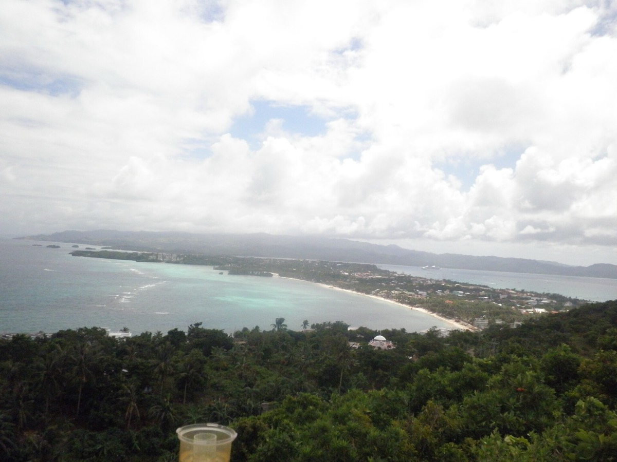
Boracay is only about seven kilometres long and in places barely a kilometre wide, and from sea level it is easy to forget that. Mount Luho is the island’s highest point, roughly a hundred metres above the sea, and from its viewing tower the whole shape becomes clear: the long pale curve of White Beach to the west, the windy blue of Bulabog to the east, and the narrow waist of land between them.
It is not a hike in any serious sense. An e-trike takes you most of the way through quiet inland lanes, and the last part is a short climb up steps. What makes it worthwhile is the contrast. Down on the beach you are inside the postcard; up here you can see the reefs, the channel to the mainland and the hills of Panay beyond.
I like it in the early morning, when the light is clean and the island below is still waking up, or on a cloudy day when White Beach feels grey but the views across the water are dramatic.
The story
Before roads and resorts, the interior of Boracay was largely coconut groves, scrub and small farm plots, with families living along the shore and fishing the reefs. High ground like Luho was useful for watching the weather and the sea, and older residents still remember when the island had more trees than buildings.
The development of the viewpoint came with tourism. A tower was built, and stalls, a few animals and small shops gathered around it, the way they do at many Philippine lookouts. It is a modest, slightly homespun place rather than a polished attraction, which is part of its charm.
From the top, the island’s geography explains its history. White Beach faces west, sheltered from the north-east monsoon, which is why it grew into the main resort strip; Bulabog faces east into the same wind, which is why it became the island’s kitesurfing beach and, during the opposite season, a sheltered place for boats. Seasons of wind decide almost everything on Boracay, from where ferries land to where people swim.
On a clear day you can also pick out Carabao Island to the north, part of Romblon province, and the green coast of mainland Aklan to the south, close enough to make you wonder how anyone ever felt isolated here.
Getting there
From Station 2, an e-trike to Mount Luho takes roughly fifteen to twenty minutes along the main road and then up inland lanes. Agree the fare first and arrange for the driver to wait, or plan to walk downhill afterwards and pick up another ride on the main road.
If you rent a scooter, the roads are narrow and steep in places; go slowly and watch for other vehicles on blind corners.
A suggested plan
- 7:00Leave early by e-trike while the air is cool and the light is clear.
- 7:30Climb the steps to the viewing tower and spend time at the top.
- 8:30Walk or ride down towards the east coast.
- 9:00Breakfast and a look at the kiteboarders on Bulabog Beach.
- 10:30Return to White Beach for a swim before the heat of the day.
Where to stay
Luho is an easy half-day trip from anywhere on the island. Staying near Bulabog or the quieter north puts you closest, but most people come from White Beach.
Good to know
- Go early; there is little shade on the tower and the sun gets strong fast.
- Bring small notes for the entrance fee and drinks.
- Combine with Bulabog Beach, which lies on the way back down.
- A cloudy day can make better pictures than a cloudless one.
- Steps and railings can be uneven; hold on and watch children closely.
- Some stalls keep caged animals for photos; you are free to decline.
- Agree e-trike fares in advance to avoid disputes.