Merbabu: an overnight hike above the clouds
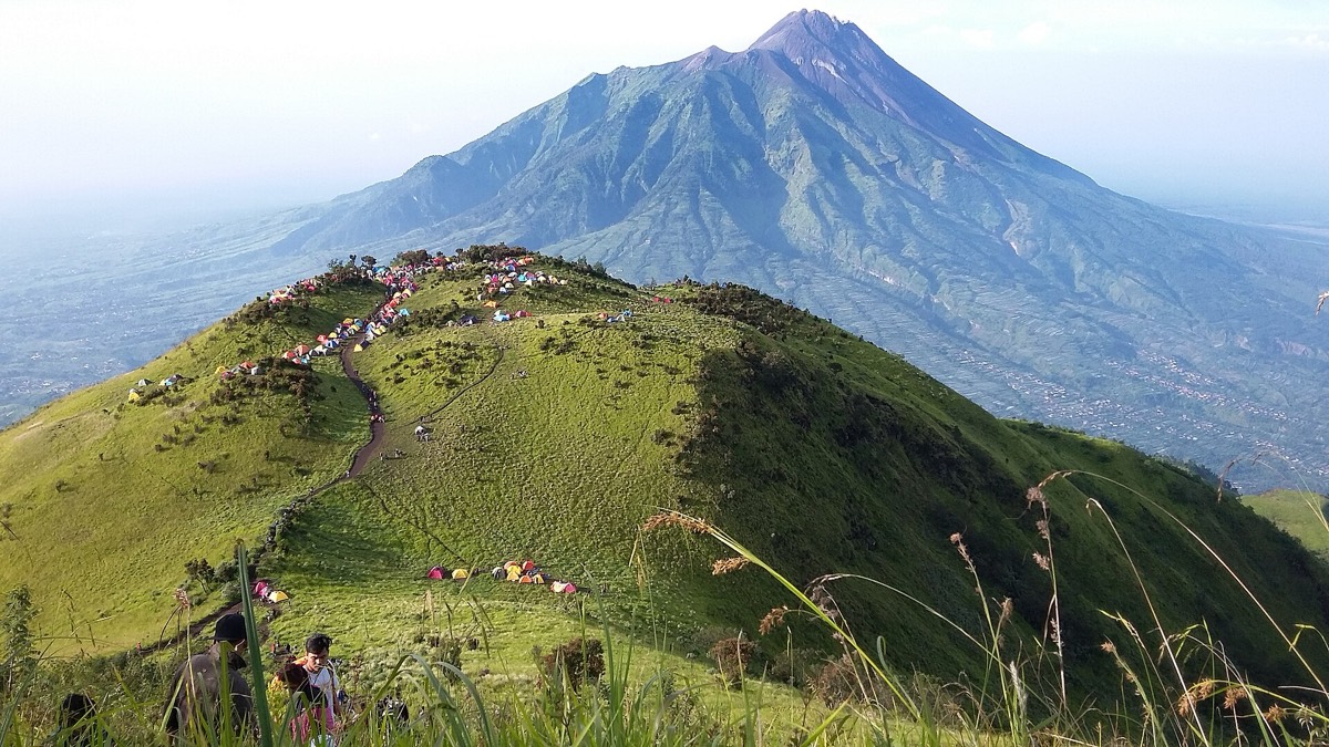
Grassy ridges, a night in a tent at 3,000 metres, and a sunrise view straight across to Merapi’s smoking crater.

- Area
- Merapi & the north
- Start from
- Selo, Boyolali
- Distance
- about 10 km up and down
- Time needed
- 2 days
- Best season
- Dry season, May – September; trails close at times in the wet season
- Difficulty
- Hard
- Transport
- Car to the trailhead in Selo; on foot
- Tickets & rules
- National park entry and climbing permit, usually booked online in advance; registration at the trailhead
Why go
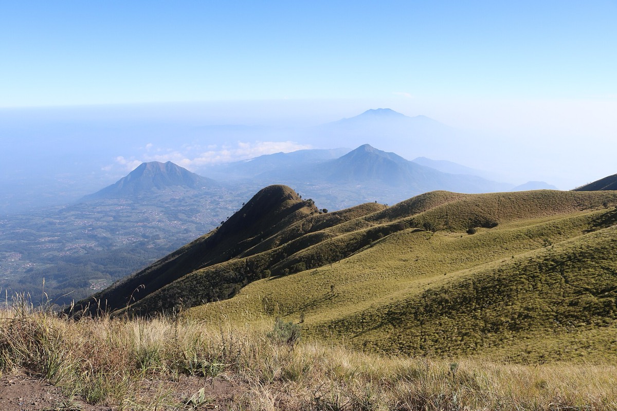
Merapi itself is usually closed to climbers, but its sleepy neighbour, Merbabu, is open for much of the year and offers one of the finest volcano hikes in Java. The name means something like ‘mountain of ash’, but its upper slopes are covered not in ash but in rolling savanna, which turns golden in the dry season.
The highlight is the view. From the summit ridges, you look across a deep saddle to Merapi, so close that on still mornings you can see the steam rising from its dome. Behind you, Sindoro and Sumbing stand like twins; further east, Lawu. On a clear dawn, the volcanoes rise from a sea of cloud.
It is not an easy walk. The trail is steep, dusty and slippery, and you’ll be climbing with a pack. But the rhythm of the hike, the cold night under the stars and the shared sunrise with Indonesian student groups singing and making coffee is unforgettable.
The story
Merbabu, at about 3,145 metres, is an old, dormant volcano with no recorded eruptions in recent history. It lies between Magelang, Boyolali and Semarang, and together with Merapi it forms part of the Javanese sacred landscape. The village of Selo sits on the saddle between the two mountains at around 1,600 metres; it was historically the starting point for climbs of Merapi as well.
Hiking volcanoes became a huge pastime among young Indonesians in the 2000s and 2010s, encouraged by films and social media. The national park now limits numbers, requires registration and has rules about waste: you may be asked to show what rubbish you are carrying when you come down.
There are several routes. The Selo trail, from the south, is popular for its open savanna and views of Merapi. Other trails start from Wekas, Suwanting and Thekelan, each with its own character. Most people spend a night at a camp area below the summit, rising before dawn to reach the top for sunrise.
The farms around Selo grow vegetables, especially cabbages, carrots and leeks, on steep terraces. Life here is shaped by the mountains, by mist, and by the knowledge that the neighbour across the saddle could wake up at any time.

Getting there
Selo is about 2–2.5 hours by car from Jogja, via Magelang and the scenic Ketep pass, or via Boyolali. Most hikers arrange a car with a driver or join an organised trek with guides and porters.
Book the climbing permit in advance through the national park’s official channels, and check whether the trail is open; closures for rest, fire risk or bad weather are common.
A suggested plan
- Day 1, 9:00Drive from Jogja to Selo, register and check gear.
- Day 1, 11:00Start the climb through forest and up to the open savanna.
- Day 1, 16:00Reach camp, pitch tents and watch the sunset over Merapi.
- Day 2, 3:30Climb in the dark to the summit area for sunrise.
- Day 2, 7:00Descend to Selo, then lunch and drive back to Jogja.
Where to stay
Selo has basic homestays for the night before or after the hike. Otherwise you can stay in Magelang or near Borobudur and drive early.
Good to know
- Nights at camp can be close to freezing; bring warm layers, a hat and a good sleeping bag.
- A local guide and porter make the trip much easier and support the village economy.
- Carry headlamps and enough water, as there are few or no water sources on the trail.
- Fog can come in quickly; stay on the marked trail and with your group.
- The descent on loose volcanic soil is slippery; trekking poles help a great deal.