Langbiang: a climb to the roof of the plateau
A hike through pine forest and grassland to the twin summits that gave Dalat its name, with views across the whole of the plateau.

- Area
- Dalat & highlands
- Start from
- Lac Duong, north of Dalat
- Distance
- about 12 km from Dalat; a 6–8 km round-trip hike
- Time needed
- 1 day
- Best season
- December – April for clearer skies
- Difficulty
- Moderate
- Transport
- Taxi or motorbike to the trailhead, then on foot
- Tickets & rules
- Entry ticket to the Langbiang area; guides are recommended
Why go
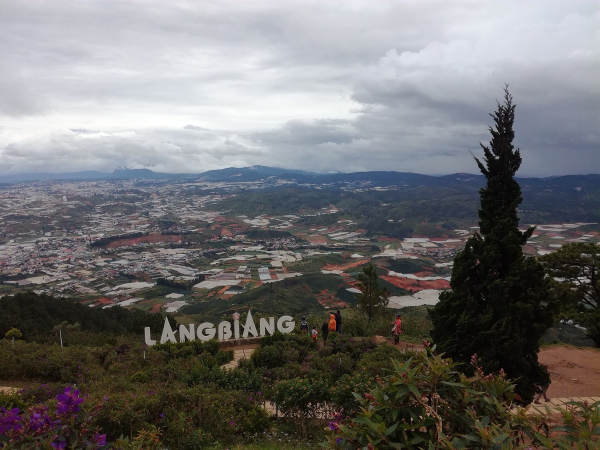
Langbiang is the highest point around Dalat, a long ridge of two peaks rising to about 2,100–2,200 metres. From the top the whole plateau spreads beneath you: pine forests, lakes, the rooftops of Dalat in the distance, and on a clear day row after row of blue ridges.
Most visitors take a jeep up to a lower viewpoint, Radar hill, which is pretty and easy. But the hike to the summit is far better. The trail climbs through pine and broadleaf forest, past moss-draped trunks and wild orchids, and out on to grassy ridges where the wind whistles and cloud races across the slopes.
It’s a real hike, steep in places and muddy after rain, but well within reach of anyone reasonably fit, and the silence at the top is worth every step.
The story
The mountain’s name comes from a legend of the K’Ho people. A young man, K’Lang, of the Lat tribe, fell in love with a girl, H’Biang, of the Chil tribe, whose families were bitter rivals. Their love was forbidden, and in the end both died; their tears, the story goes, formed the streams of the plateau, and the two peaks are their bodies, lying side by side.
The French built on the plateau below the mountain, and the name Dalat itself is often linked to the Lat people who lived here. The village of Lac Duong at the foot of the mountain is still home to many K’Ho and Lat families, and you will see their traditional textiles and baskets for sale.
The Langbiang area was declared a UNESCO biosphere reserve in 2015. It holds an exceptional variety of plants, including rare conifers and many orchids, and is home to several endemic birds.
The jeep road to Radar hill was built to service an old station on the ridge; today it carries visitors, and on weekends the lower viewpoint fills with families taking photographs. A few hundred metres beyond them, on the summit trail, you can walk for an hour without meeting anyone.

Getting there
Lac Duong is about 12 km north of Dalat, 20–30 minutes by taxi or motorbike. The trailhead is near the ticket office at the foot of the mountain.
Allow about three to four hours up and two to three down. Local guides can be booked in Dalat; they know the trails and the weather.
A suggested plan
- 7:00Leave Dalat for Lac Duong.
- 7:30Start the hike through the pine forest.
- 10:30Reach the summit; rest and enjoy the view.
- 12:00Descend, with lunch on the trail.
- 3:00 pmBack at the foot of the mountain; coffee in Lac Duong.
Where to stay
Stay in Dalat. A few homestays in Lac Duong offer a quieter base and a chance to meet K’Ho families.
Good to know
- Wear proper walking shoes and bring a rain jacket.
- Pack water, snacks and a warm layer for the summit.
- Start early to avoid afternoon cloud.
- Buy textiles directly from weavers in Lac Duong.
- Fog can descend quickly; don’t wander off the trail.
- Trails are slippery after rain, and getting lost is possible without a guide.