The Khanh Le pass: from the sea to the pines
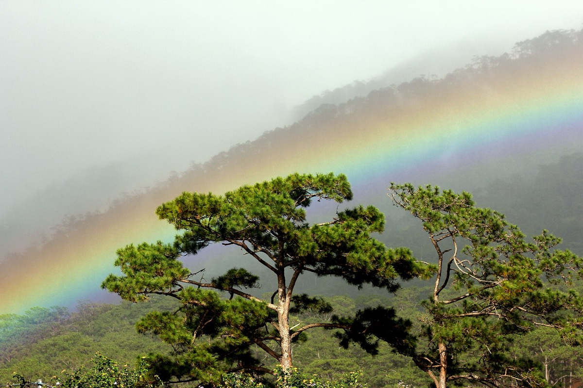
One of Vietnam’s most dramatic roads, climbing from coconut palms through mist-filled jungle to the cool pine forests of the Langbiang plateau in a single morning.

- Area
- Dalat & highlands
- Start from
- Nha Trang
- Distance
- about 135 km to Dalat
- Time needed
- 1 day
- Best season
- January – August; landslide risk in the rainy months
- Difficulty
- Moderate
- Transport
- Car, bus or motorbike
- Tickets & rules
- None
Why go
For a long time the drive from Nha Trang to Dalat meant a long detour through Phan Rang. Then a new road was pushed straight across the mountains via Khanh Vinh, and with it came the Khanh Le pass, a long sweep of hairpins climbing through a near-unbroken forest. It’s the shortest way to Dalat, and by far the most beautiful.
The change is amazing. You leave the coast among rice fields and coconut palms, cross the flat country around Khanh Vinh, and then the road begins to climb. The air cools, waterfalls drop off the cliffs beside the road, cloud flows through the valleys below you, and at the top the first pine trees appear.
If you ride or drive yourself, stop often: at roadside streams, at viewpoints over endless ridges, and at the small stalls selling corn and coffee near the top.
The story
The road, part of National Route 27C, was opened in the late 2000s and cut travel time between the coast and Dalat dramatically. The pass itself is often said to be around 33 km long, among the longest in Vietnam, climbing well over a thousand metres.
The road runs through Bidoup–Nui Ba National Park, a large area of montane forest that is part of the Langbiang biosphere reserve recognised by UNESCO in 2015. The forest holds pines, oaks, rhododendrons and rare conifers, and wildlife including several primate species and a rich bird life, though you will rarely see animals from the road.
The mountains here are home to the K’Ho people, one of the indigenous groups of the Central Highlands. Villages along the upper part of the road grow coffee and vegetables, and you will see wooden houses, women carrying baskets on their backs, and children walking home along the verge.
In the rainy season, especially October to December, heavy rain loosens the slopes, and landslides have closed the road for days at a time. On a dry day, though, it is one of the great drives of the region.
Getting there
Buses and limousine minibuses run between Nha Trang and Dalat several times a day, taking roughly four hours. A private car lets you stop where you like. Experienced riders can take a motorbike, but the descent is steep and long.
Start early: the views are clearest in the morning, and the clouds tend to roll in after midday.
A suggested plan
- 6:30Leave Nha Trang heading west towards Khanh Vinh.
- 8:00Begin the climb; stop at the first viewpoints and waterfalls.
- 9:30Coffee near the top of the pass among the pines.
- 11:00Through the forest and the farms of the plateau.
- 12:30 pmArrive in Dalat for lunch and a sweater.
Where to stay
There is little to stay along the route itself; plan to sleep in Nha Trang the night before and in Dalat the night after.
Good to know
- Bring a warm layer; it can be over 15 °C cooler at the top than on the coast.
- Fuel up and get cash in Nha Trang or Khanh Vinh.
- If you get carsick, sit at the front and take a tablet before you start.
- Rain gear is useful even in the dry season.
- Check the weather and road news before going in the rainy season; landslides and rockfalls are a real risk.
- Hairpins and heavy trucks make it a demanding ride; don’t attempt it as a beginner on a motorbike.